
PerchPoints / Case study
Turning a photographic archive into a place to explore.
How photography, maps, and practical place information come together in one custom atlas.
Visit the live website ↗- Discipline
- Product design / Interactive development
- Project
- A Mr. Crowmeister project; built and cared for by Raven Rendering.
- Year
- 2026
The starting point
Make the archive useful.
A photograph can make someone want to visit a place. The next questions are practical: where is it, what is the outing, and how does it fit into a trip? PerchPoints brings those questions into the same experience as the photographs.
My role Product strategy, information architecture, interface design, implementation, and continuing website care.
Inside the work
Three decisions that shape the experience.
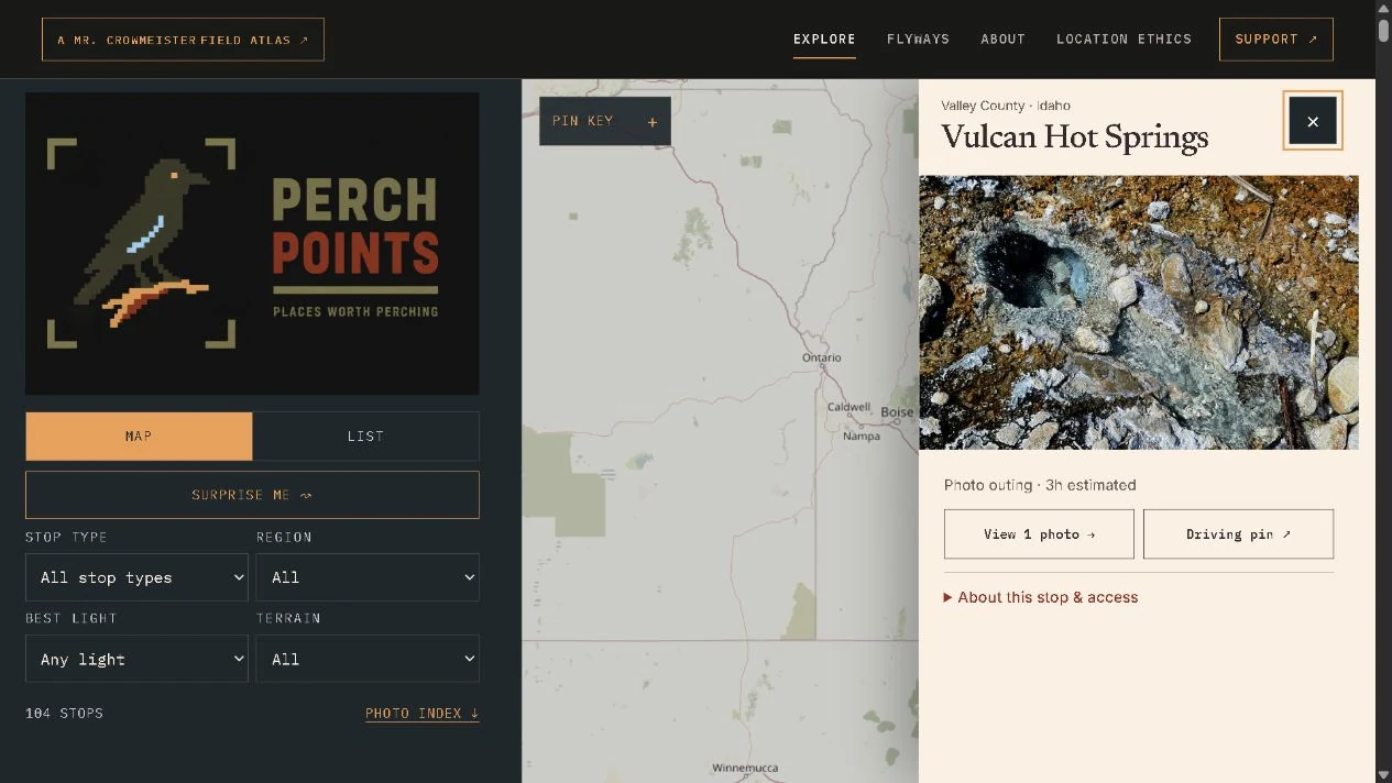
Keep place and photograph connected.
A selected stop opens beside the map on larger screens. Its photograph, outing estimate, and links stay together, so visitors can explore without losing their geographic context.
Let visitors choose how to explore.
Map and list views offer two ways into the same collection. Filters for stop type, region, light, and terrain make a growing archive easier to narrow down.
Make the limits of the information visible.
Location confidence and access notes distinguish a public waypoint from precise route guidance. The interface makes room for this context alongside the practical details.
Designed for smaller screens
The same place, with room to breathe.
On a phone, the desktop columns become a vertical sequence. Filters are available when needed, the map keeps its space, and the selected outing follows below. The visitor can move between the location and its photographs on a smaller screen.
Explore PerchPoints ↗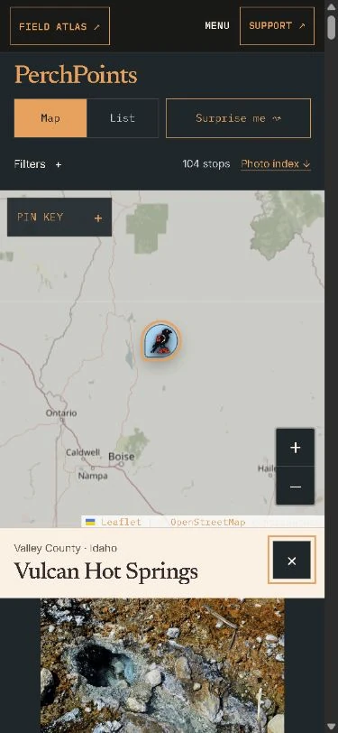
The finished work
A website with a job to do.
A working photographic atlas with map and list exploration, place filters, individual photo collections, and connections to planned road trips. The collection can grow within a consistent structure.
Explore specialized website projects ↗